On Wednesday, November 17th, 2004 the New Hampshire Space Grant Consortium and Complex Systems Research Center
hosted their sixth annual GIS Day Conference and College Fair at the Institute for the Study of
Earth Oceans and Space at the University of New Hampshire. GIS Day is a day set aside during National
Geography Awareness Week for Geo-Spatial Science professionals to reach out and educate people of
all ages about the important contributions that Geo-Spatial Science related technologies make in all
of our lives. Invited guests to the 2004 GIS Day conference include hundreds of high school
junior and senior level students and home schooled students from all over the state of New Hampsrhire
during our morning sessions and Geo-Spatial Science professionals, university level students and the
general public during our open afternoon sessions. Total attendance for the day topped off at over 1000 people.
All GIS Day 2004 conference guests were hosted to many attractions and events including the
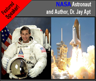
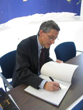
a presentation by the 2004 keynote speaker, Astronaut and Author Dr. Jay Apt. Dr. Apt took all GIS Day 2004
guests on an exciting tour of Earth as viewed through the photography of NASA astronauts from Earth's
orbit. He reviewed Geography, natural change, and change to the planet caused by people as he presented
his unique views of our world. Many of the stunning photographs that he displayed were from his National
Geographic book Orbit: NASA Astronauts Photograph the Earth. Dr. Apt finsihed off his presentation with
a book signing in the GIS Day Store.
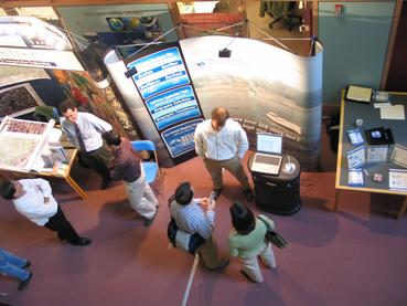
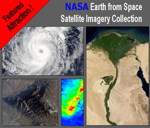
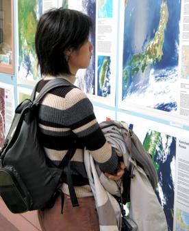
All GIS Day 2004 guests were also hosted to the NASA Earth from Space Satellite Imagery Exhibition.
This exhibition of high resolution satellite image products displayed spectacular regional views of the
Earth from Space including beautiful images of the United States, Amazon Basin, Antarctica, South East
Asia, Africa, Europe and the Middle East as captured by the MODIS sensor on baord the NASA Earth
Observing System flagship satellite "Terra". In addition to satellite imagery, all guests were also
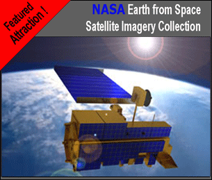
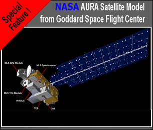
given the opportunity to view a special display of Scale Models of the latest NASA Earth Observing
System Satellites, AURA, and AQUA.
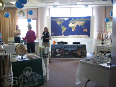
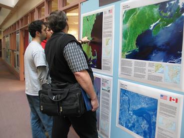
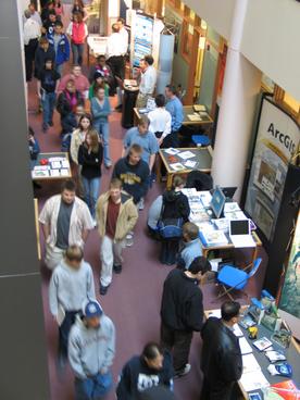
All guests were also treated to an extensive modern cartographic exhibition,
a Geo-Spatial Science college fair and hands on tours of Complex Systems Research Center's state of the art
GIS and Remote Sensing laboratory. This GIS Day 2004 Modern Cartographic
Exhibition featured over one hundred
maps and posters from presenters from all around the state. Invited presenters included professionals
from many sectors of the Geo-Spatial Science community including urban planning, resource management,
emergency management, education, science, government, and industry. This GIS Day 2004
Geo-Spatial Science College Fair
featured representatives from many regional Geo-Spatial Science undergraduate, graduate degree
and certificate programs. Morning student guests were also treated to a series of talks about the Geo-Spatial
Sciences and the educational and career opportunities that they have to offer. Afternoon guests were hosted
to a professional hardware, software and geographic products Vendor Hall and product demonstrations from leading companies and organizations in the Geo-Science industry.
In an effort to further enhance geographic knowledge all students guests were also provided with packets that included additional information about Geo-Science related technologies and topics and career and educational opportunities in the Geo-Sciences. All students were also provided with a new Merriam WebsterNotebook Atlas and a series of souvenirs including maps and other items just for attending.
|