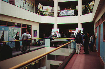
 On November 15th, 2000 the New Hampshire Space Grant Consortium and Complex Systems
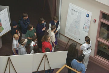
Research Center hosted their second annual International GIS Day events at the institute for the Study of Earth Oceans and Space on the University of New Hampshire campus. Hosted guests included upwards of one hundred high school students from four New Hampshire high schools during the morning sessions. Attending high schools included Coe-Brown Academy (Northwood, NH), The Community School (South Tamworth, NH), Merrimack High School, (Merrimack, NH) and Oyster River High School (Durham, NH). All attending students were hosted to an extensive cartographic exhibition featuring over seventy maps and posters from over thirty-five presenters from around the state. Invited presenters included professionals from many sectors of the Geo-Spatial Science community including, urban planning, resource management, emergency management, education, science, government, and industry. Hosted students were also treated to a hands on tour of Complex Systems Research Center's GIS and Remote Sensing Laboratory and to a series
of talks about the Geo-Spatial Sciences and the educational and career opportunities that they have to offer. On November 15th, 2000 the New Hampshire Space Grant Consortium and Complex Systems
Research Center hosted their second annual International GIS Day events at the institute for the Study of Earth Oceans and Space on the University of New Hampshire campus. Hosted guests included upwards of one hundred high school students from four New Hampshire high schools during the morning sessions. Attending high schools included Coe-Brown Academy (Northwood, NH), The Community School (South Tamworth, NH), Merrimack High School, (Merrimack, NH) and Oyster River High School (Durham, NH). All attending students were hosted to an extensive cartographic exhibition featuring over seventy maps and posters from over thirty-five presenters from around the state. Invited presenters included professionals from many sectors of the Geo-Spatial Science community including, urban planning, resource management, emergency management, education, science, government, and industry. Hosted students were also treated to a hands on tour of Complex Systems Research Center's GIS and Remote Sensing Laboratory and to a series
of talks about the Geo-Spatial Sciences and the educational and career opportunities that they have to offer.
 In an effort to further enhance geographic knowledge, students were
provided with packets which included additional information about Geo-Spatial Science related technologies, career and educational opportunities in the Geo-Sciences, interesting earth facts, information about famous geographers and a geo-quiz. All students were also provided with a new Merriam Webster Notebook atlas, a GIS Day 2000 satellite image composite map of New Hampshire and a series of souvenirs including pens, buttons, and stickers. In total, throughout the day, the 20+ person GIS Day 2000 staff were able to give away over 125 atlases, 125 globes, 150 National Geographic Magazines, 200 maps and posters and over 300 souvenirs to the GIS Day 2000 guests.
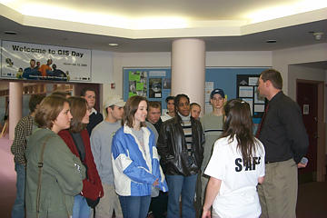
In addition to our morning guests, over 175 New Hampshire geo-spatial science professionals and University of New Hampshire students attended the afternoon session of GIS Day 2000 to view the extensive cartographic map and poster gallery exhibition and to perform professional networking. Afternoon guests were also treated to a hands on tour of Complex Systems Research Centers GIS and Remote Sensing Laboratory for spatial analysis and to an extensive information table which featured handouts and give-aways from Environmental Systems Research Institute (ESRI), ERDAS, the US Geological Survey (USGS), UNH, the National Geographic Society, GRANIT, and Complex Systems Research Center.
|