|
The GIS Day Tenth
Anniversary Map Collection to be on display at this year's
GIS Day conference will contain the best sub-collections of cartographic and satellite image
products from GIS Day collections from over the last ten years as well as new sub-collections
which will allow viewers to explore amazing locations from around the world. A selection of
over one hundred and fifty full color maps, photographs and images portraying global, regional
and local locations of interest will be on display. So come explore the world with us on
November 12th! It will be a World of Fun!
|
|
Exhibition Sub-Collections
US National Park Service Maps (GIS Day 2007)
UNESCO World Heritage Site Maps (GIS Day 2007)
NOAA Ocean Mapping Images (GIS Day 2006)
National Geographic Society Maps (GIS Day 2005)
NASA Satellite Images (GIS Day 2004)
Library of Congress Antique Maps (GIS Day 2003)
NASA 3 1/2 ft Satellite Image Globe (GIS Day 2002)
NH GRANIT Maps (GIS Day 2001)
USGS Topgraphic Maps (GIS Day 2000)
GIS Day Posters (GIS Day 1999 to 2008)
|
 |
|
 |
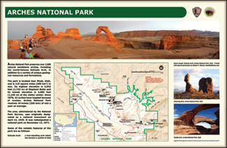
| Arches National Park map and images (US NPS) |
|
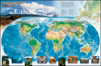
2006-2007 UNESCO World Heritage Sites (UNESCO) |
 |
|
 |
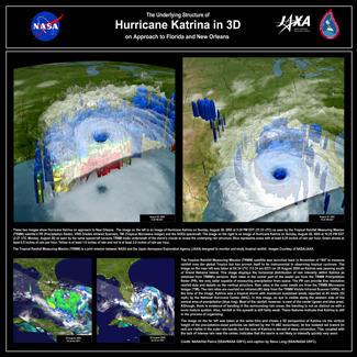
| Hurricane Katrina in 3D (NASA) |
|
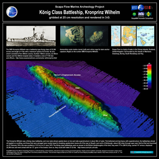
Sonar Image of WWI German BattleShip (CCOM) |
 |
|
 |
| Map of Antarctica (NGS) |
|
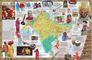
Map of Indian History (NGS) |
 |
|
 |
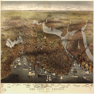
| Antique Map of Boston, MA (US Library of Congress) |
|
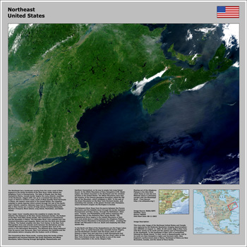
Satellite Image of the Northeastern US (NASA) |